Trails, Backpacking, News, more...
The Franconia Ridge Trail Guide

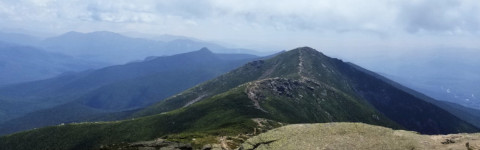
Located within The White Mountains National Forest, The Franconia Ridge Loop is a widely popular hike that draws hikers from around the globe. The Franconia Ridge is accessible via a number of well marked and well maintained trails. Much of the ridge is located above the treeline in the alpine zone where there is fragile plant life. This loop route will pass over 2 high peaks above 5,000ft, Mount Lafayette and Mount Lincoln, as well as Little Haystack Mountain at 4,760ft.

Key Features
  • Mount Lafayette at 5,249ft is the tallest peak on the loop.  Mount Lincoln is over 5K as well at 5,089ft.
  • Falling Waters Trail ascends the side of Little Haystack Mountain alongside countless water falls.
  • The Franconia Ridge. Breathtaking unobstructed views above tree-line for approx. 1.7 miles.
  • Appalachian Trail section. The Ridge is also a small portion of the world famous Appalachian Trail. Look for the white blazes.
  • Beautiful flora and fauna, add an extra half of a pound to base weight for binoculars not just for wildlife, but for the views.
  • While on the ridge you will view the large Pemigewasset Wilderness to the east.
  • The Old Bridle Path offers numerous vistas that overlook the western valley below the ridge and views of Cannon Mountain as well.
Trail Guide Disclaimer

This guide uses a counter clockwise loop route ascending Falling Waters Trail, over Franconia Ridge, and down the Old Bridle Path.

Trailhead
Trailhead: I-93N Lafayette Place
Trail Junction
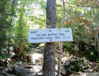
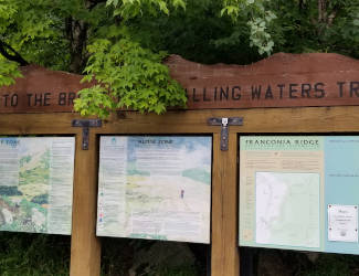
0.2mi: Up Falling Waters Trail
Slippery Rock
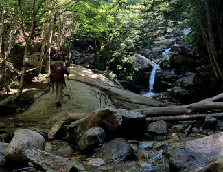
0.8mi: Slippery Rock
Cloudland Falls
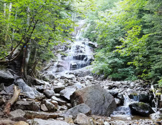
1.2mi: Cloudland Falls
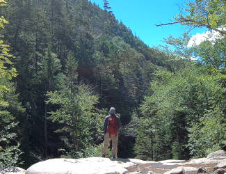
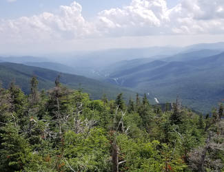
Vista
1.3mi: Vista
Trail
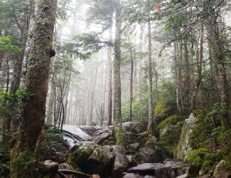
2.0mi: Lots to climb
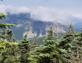
First Views
2.8mi: First Views
Little Haystack Summit
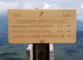
3.0mi: Little Haystack Summit
Franconia Ridge
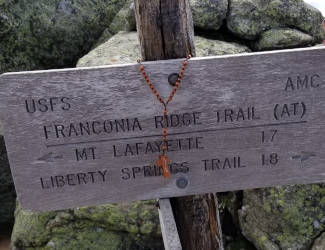
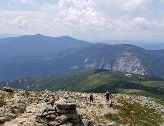
3.1mi: Franconia Ridge
Franconia Ridge
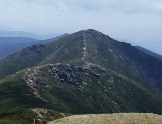
3.6mi: Mount Lincoln
Mount Lafayette
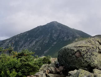
4.5mi: Mount Lafayette
Old Bridle Path
4.6mi: Old Bridle Path
Greenleaf Hut
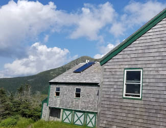
5.7mi: Greenleaf Hut
Overlook
6.1mi: Overlook
The next 2.5mi descends down the Old Bridle Path with the occasional vista looking back at the ridge or to the west and Cannon Mountain. Continue on and once you reach the trail junction with the Falling Waters Trail you know you're almost to the parking lot with just 0.2mi left. Congratulations, you've completed the Franconia Ridge Loop!
Links

FranconiaRidge.com

Franconia Notch State Park Trail Map

Franconia Notch Hiker Parking Information

Nearby Hikes

Falling Waters Trail To Little Haystack

Mount Willard, Crawford Notch

The Franconia Ridge
The Franconia Ridge
Location Franconia, NH
Coordinates 44.142187, -71.681583
Max El. 5249ft
Difficulty 9/10
Popularity Very High
Franconia Ridge On YouTube
Disclaimer    Return To Guide

Be advised, while we do strive to provide as accurate a representation of areas as we can, errors can be present due to trail updates, closures, regional changes, etc. Distances may not be perfectly accurate. This site is intended to serve as a simple introduction when visiting an area that we cover. Before heading out on your adventure conduct further research from official sources and plan accordingly. Intotheabsurd.com and it's content creators assume no liability from individuals carelessly and irresponsibly using this website as a sole source of information about areas covered on this website.