5 Family Friendly Catskills Hikes

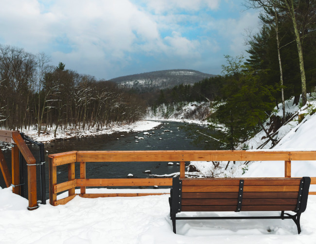
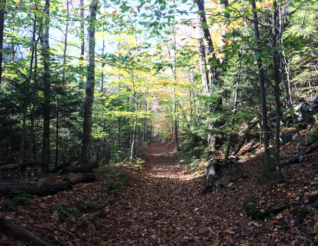
1. Ashokan Rail Trail
- Easy trail for everyone
- Restroom facilities at the 3 trailheads
- 11.5 miles in legnth
One of the easiest and most scenic trails of the Catskills is the recently completed Ashokan Rail Trail. This trail can be hiked by persons of any age and the compact stone surface is accessible for persons with disabilities according the trail's website. The Ashokan Rail Trail runs 11.5 miles west to east along the northern shore of the Ashokan Reservoir. There are 3 trailheads with parking, one on the western side in Boiceville, one on the eastern side in West Hurley, and one in the center in Shokan. The Ashokan Rail Trail was completed in December 2019 at a cost of $16.2 million.
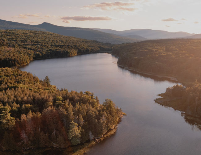
2. North South Lake Loop
- 2 lakes and 2 beaches
- Approx 2.4 miles of loop trail
- Kayak and non-motor boat rentals
North South Lake in the Catskill Mountains is a family friendly outdoor recreation destination. The Yellow Trail loop around the lake is mostly easy and circles the lake around it's shore line with some of the trail venturing into the wooded areas surrounding the lake. There are numerous other outdoor activities that are available at North South Lake such as camping, boating, hiking, and fishing. The shore line of the lake is approximately 2.3 miles. North South Lake is a wonderful family outdoor destination.
NYDEC North South Lake Information
MaMa's Pizza and Trattoria (15 minute drive)
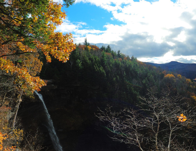
3. Kaaterskill Falls
- 1.6 miles round trip
- Beautiful double tier waterfall
- One of the most photographed waterfalls on Earth
Trailhead, Laurel House Road, GPS: 42.196104, -74.063130
This family friendly hike in the Catskill Mountains includes one of the most stunning waterfalls in the United States. Kaaterskill Falls is also allegedly the most photographed waterfall on Earth. This is possibly true as this is usually a very crowded hike especially in the summer and fall. Kaaterskill Falls is a 2 tier waterfall with a combined height of 260ft. The hike is family friendly but with a good amount of stone stairs and a bit of rocky trail that could possibly be difficult for some to navigate.
NYDEC Kaaterskill Wild Forest Info
MaMa's Pizza and Trattoria (15 minute drive)
4. Diamond Notch Falls
- 1.6 miles round trip
- Beautiful hike along the West Kill River
- Picturesque Diamond Notch Falls
Trailhead, Spruceton Road, GPS: 42.182384, -74.269542
Along an old carriage road that is now a hiking and bicycle corridor, the hike to Diamond Notch Falls in the Catskill Mountains begins with a beautiful nature walk along the West Kill River. With numerous photo and break opportunities along the river, the hike culminates upon reaching the picturesque Diamond Notch Falls. Cross the wooden bridge over the waterfall to catch a glimpse of the waterfall from the other side.
NYDEC Hunter-West Kill Wilderness Info
The trailhead to this hike is located far along a country road, Spruceton Road. It is equally distant to the towns of Hunter and Phoenicia at around 19 miles.
MaMa's Pizza and Trattoria (Hunter)
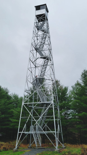
5. Catskills Visitor Center Trails And Fire Tower
- 80ft Upper Esopus Fire Tower
- Esopus Creek
- Family Friendly Nature Trails
The Catskills Visitor Center is a nice introduction to individuals and families new to the Catskill Mountains. With the 80ft Upper Esopus Fire Tower that is available to climb and catch a bird's eye view of the surrounding forest, mountains, and Esopus Creek. Be sure to check the Visitor Center's building hours for further information if you're just starting to discover the Catskill Mountains. There are picnic areas, short hiking trails, and access to the Esopus Creek.
Catskills Visitor Center Website