Trails, Backpacking, News, more...
Kaaterskill Falls Overlook Trail Guide

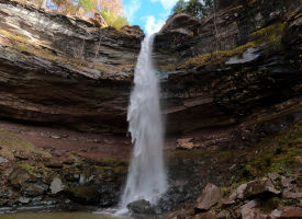
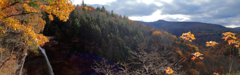
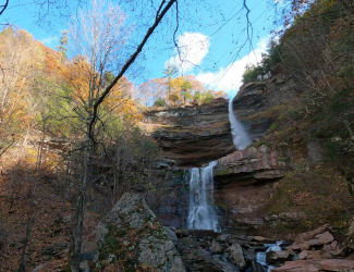
Located in Greene County New York in the Catskill Mountains, Kaaterskill Falls is a double tier and one of the tallest waterfalls in the northeastern United States. The upper and lower sections of the falls have a combined height of 260ft. There are a number of trails that give access to the lower falls as well as a viewing platform and ledges.

Key Features
  • There are various hiking trails to the falls.
  • Double tier waterfall with a height of 260ft.
  • Lower falls has a rocky outcrop for sitting and viewing.
  • Unique geological formation.
  • Access to the middle tier of the waterfall.
Trail Guide Disclaimer

This guide starts at the trailhead at Laurel House Road, GPS: 42.196104, -74.063130
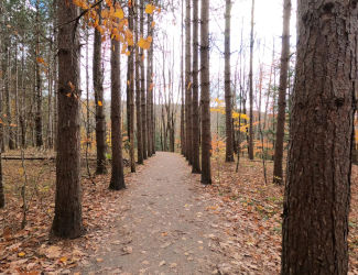
Flat Path
0.1mi: Flat Path
Bridge Over Spruce Creek
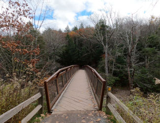
0.3mi: Bridge Over Spruce Creek
Stone Stairs
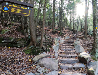
0.3mi: First Stone Stairway
Trail Junction
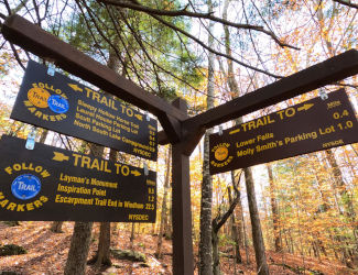
0.4mi: Trail Junction To Lower Falls
Slow Descent
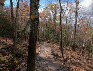
0.5mi: Slow Descent, Stone And Dirt
Stairs To Lower Falls
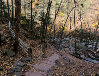
0.7mi: Stone Stairs To Rocky Base
Base Of Falls
0.8mi: Base Of Falls
After reaching the base of Kaaterskill Falls turn around and head back up the trail the way you came. Congratulations! You've visited Kaaterskill Falls!
Links

NYDEC Kaaterskill Wild Forest Info

Nearby Hikes

Wittenberg Mountain

Giant Ledge

Other Catskills Hikes

5 Family Friendly Catskills Hikes

5 Catskills Hikes With Stunning Vistas

Kaaterskill Falls
Kaaterskill Falls
Location Haines Falls, NY
Coordinates 42.196104, -74.063130
Falls Height 260ft
Difficulty 2/10
Popularity Very High
Kaaterskill Falls On YouTube

It can not be stressed enough to plan accordingly for venturing out into the wilderness whether it is for a multi-day backpacking trip or even for the simplest of day hikes. An innocent stray off course and an easy overlook of essential gear can result in disaster with life threatening consequences in an instant, even for the most avid backcountry trekker.

Disclaimer    Return To Guide

Be advised, while we do strive to provide as accurate a representation of areas as we can, errors can be present due to trail updates, closures, regional changes, etc. Distances may not be perfectly accurate. This site is intended to serve as a simple introduction when visiting an area that we cover. Before heading out on your adventure conduct further research from official sources and plan accordingly. Intotheabsurd.com and it's content creators assume no liability from individuals carelessly and irresponsibly using this website as a sole source of information about areas covered on this website.